
PIN PARVATI PASS TREK
The Pin Parvati Pass trek is unquestionably one of the most enthralling trans-Himalayan treks. This challenging and strenuous trail is only for seasoned and physically fit hikers who have completed at least two, if not three, high Himalayan multi-day camping treks. Spiti’s trans-Himalayan valleys were once difficult to reach, but the Pin Parvati pass path cuts the gap between the Kullu and Spiti valleys in half. The trail was first opened to hikers in 1993. Despite the fact that the trek is strenuous and difficult, the region’s beauty makes it one of the most common Trans-Himalayan treks.
By noon/afternoon, you should be in Manali (altitude: 1950 m/6400 ft). Our guest house will be either in Manali town or in Vashisht, which is 3 kilometres away. Vashisht has a shrine, which is known for its hot spring inside. After that, go for a stroll to the Jogini Drop (Vashisht). Guests are accommodated in a cabin or a guest house.
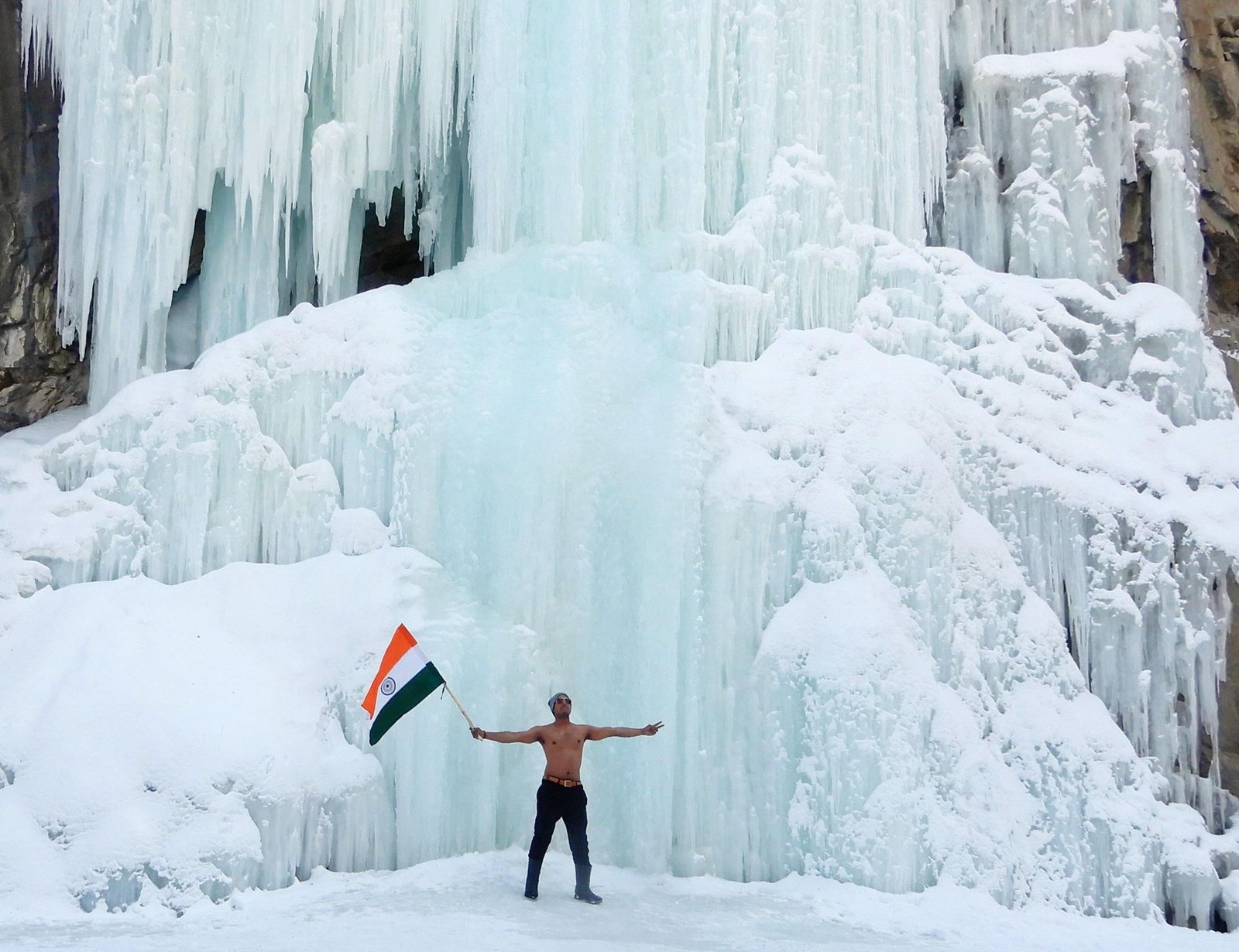
Pick up in the early morning from Manali and drive to Barsheni (2200 m, 7200 ft) via Kasol and Manikaran. The distance is approximately 110 kilometres, and it will take approximately 4 hours to complete. From here, the trek begins. The trail ahead is a 9-kilometer hike through a beautiful forest to Khirganga's open meadow (2920 metres, 9580 feet). This is the hot spring where Lord Shiva meditated, according to legend. In the season, one should take a relaxing bath. It will take about 5 hours to complete the climb. In the tent for the night.
The 12 km walk to Tundabhuj (3400 m, 11150 ft) is fun, as we follow the Parvati river valley once more. The gentle ups and downs, as well as the passage through lovely grazing grounds and stretches of montane conifer woodland, give the trail the feel of a classy Himalayan trail. On sometimes, we will see the river on our left. The camping ground is located on the outskirts of a birch woodland. As we camp on the true left of Parvati, the Parvati river rambles through the gorge to our left. A sheer rock wall with five separate spikes jutting up from the other side of the channel. Legend has it that these are the five Pandavs, who are known as Pandu Shilla. We're going to set up camp for the night.
Today's hike will take you to Thakurkuan (3600 m/11800 ft). We're following the river's route. The trail gets challenging after a while, and we walk on a narrow rocky path. In 2014, the wooden bridge that crossed the river washed down, and since then, the track has followed the true left of Parvati all the way to Thakurkuan. We used to have to cross the river again over a hand-drawn Pulley Bridge, but that is no longer necessary. After about 2 kilometres, a wide vista opens up. There are many wild flowers in the panorama, including iris and poppies, to name a few. For the day, we set up camp in the valley. The distance is 6 kilometres, and it will take 3 to 4 hours to complete.
We continue down the river for the rest of the day. We cross a side stream over a boulder after a while. The pool is known as Chhota Pandu, and the traverse on the rock exposes the stream that runs 30 feet under it. Following that, we cross the main river by way of a massive boulder that spans the Parvati River. This is known as Pandu Pool and is a wonder of local engineering. The water will be on our right from now on, and we will really be in the real right of the river. After crossing the bridge, a climb begins immediately and lasts for an hour. When we hit the mountain's shoulder, we turn left and walk gently across a large alpine meadow. At the end of this meadow is Odi Thatch's campsite.
Today's hike will take us to Mantalai (4100 m/13500 ft), which is thought to be the source of the Parvati River. The trail is gradual at first along the gorge, but when the valley widens, so does the water rush. Because of the river's shallow flow, a swamp land stretches for around a kilometre. Chhota Mantalai is the name of the neighbourhood. A rock wall can be seen across the river at a distance. We abruptly leave the vegetation behind and join the glacial moraine and waste. The glacier's snout is easily visible. We follow a moraine ridge that dams the Mantalai Lake and ascend it. Every exhausted trekker would be awestruck by the vastness of Mantalai from the top of this mountain. We are greeted by a shrine, cairns, and flags.
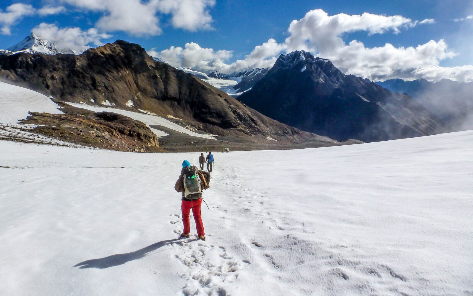
Today has been a long and difficult day. We leave the camp early in the morning and travel down the valley after passing a side stream. As we scale a steep and steady slope, we hold to the left. This is a challenging segment. We turn left at the top of the climb and reach a rock and boulder section. Over boulders, we encircle the zone. Another icy stream gushing from the glacier is only waiting for us to cross. We reach the glacier's start after a final scramble up a steep slope. This is the glacier that originates from Parvati Pass's watershed. For the Parvati side base camp (5000 m, 16500 ft), we camp at the glacier's edge. The distance is 10 kilometres, and it could take up to 8 hours to complete.
Today we set off early in the morning through the vast open ice field that leads to the eastern pass, which takes 4 hours to enter. We must cautiously navigate the crevasses and frozen slopes. We see the glacial lake formation and snow-capped peaks while walking on the permafrost region. On the ice, there are a few crevasses that must be navigated. We ascend a steep rocky ridge and the final stretch to meet the Pin Parvati Pass (5300 m/17400 ft). The pass has a panoramic view of Spiti's peaks and valleys. We make our way down from the pass, first on snow and ice, then on loose scree.
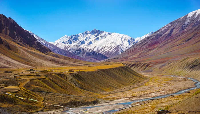
The valley is now traditional Spitian in appearance, dry except with patches of grass and scree. We start early in the morning and descend steadily along the left bank of the Pin River (as long as we remain to the true left of the river). We travel 13 kilometres to Chinpatta Maidan (4000 m/13120 ft). On the other side of the canal, the road leading to the Bhaba Pass for Kinnaur can be seen. As the Pin valley broadens out, the scenic abundance of coloured mountains mesmerises you. The path descends gradually along the river's left bank until it meets Mud (3750 m, 12300 ft), the first village in the Pin valley, which is another 12 kilometres away. It will take about 10/11 hours to complete the trek.
We take the road back to Manali via Kaza, Lohsar, Kunzum La to Chhatru, and then over Rohtang Pass to Manali on the final day of the journey. This is where the journey comes to a close.
- Pick and Drop Service from mentioned location
- Fees for the guide and the chef
- Camping facilities' rent
- Entrance fees to the forest
- To transport camping gear, a porter and mule are required. Please keep in mind that personal baggage can be borne by mules and/or porters for a fee
- From the first day's dinner until the last day's brunch, both of the meals are vegetarian
- Throughout the walk, you'll be staying in a tent or if possible, then in a guest house
- No pickup and drop point from/for your hometown
- Personal costs include things like tips, personal medications, and conference calls, etc
- Apart from what is mentioned above, some transportation assistance during the trek
- Porters/mules can carry personal luggage weighing up to 12 kg per bag per person for Rs 350 per day per bag