
Kedartal Trek
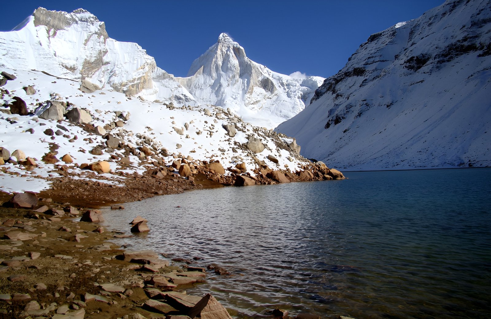
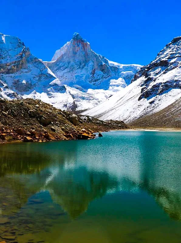
Kedar Tal, also known as Shiva’s Lake, is a glacial lake in India’s Garhwal area that sits at an elevation of 4,750 meters (15,600 feet). The lake is fed by snowfall on the surrounding peaks of Mt Thalay Sagar (6,904m), Meru (6,672m), Mt Bhrigupanth (6,772m), and others, which are also the source of Kedar Ganga, which is considered Lord Shiva’s contribution to Bhagirathi in Hindu mythology (a source-stream of the Ganges). The proximity to majestic peaks, as well as the view that this trek provides, will make you believe in magic. The lake is a true gem of Uttarakhand, with crystal-clear blue water and the coolest drink of water you’ll ever find.
The trailhead of Gangotri, where the trek starts, as well as the holy town of Gangotri, which is said to be the source of the Ganges River, add to the allure of this trek. During the yatra season, the city comes alive with markets, temples, nightly aartis, and forests teeming with sadhus. After your trek, set aside a few days to explore the region. The months of May, June, September, and October are ideal for the Kedartal trek. Continue reading for more information about the Kedar Tal trek, including a route map, itinerary, temperature chart, photographs, and videos.